![]()
Funded by NASA
Sea surface salinity (SSS) is one of the most important climate variables and a key indicator of changes in the marine hydrological cycle. Characterizing, quantifying, and understanding the distribution of SSS and its variability is crucial for understanding changes in the regional and global climate and for climate monitoring and prediction.
Recognizing the importance of SSS data, and the need for a consistent, continuous, long-term, high-quality, and high-resolution dataset for oceanographic research and applications, the OISSS project develops such a dataset from multi-satellite measurements.
The multi-mission OISSS dataset combines observations from NASA’s Aquarius/SAC-D, Soil Moisture Active-Passive (SMAP) and the European Space Agency’s Soil Moisture and Ocean Salinity (SMOS) satellite missions. The analysis is based on Optimum Interpolation (OI), utilizes Level 2 orbital data, and uses satellite-specific bias-correction algorithms to correct satellite retrievals for biases with respect to in-situ data.
Version 3.0 of the OISSS product, recently released, incorporates improved bias-correction algorithms, improved estimates of the signal and error statistics, and provides improved spatial coverage and resolution. The dataset is provided on a regular 0.25° x 0.25° latitude-longitude spatial grid and covers the period from September 2011 to the present.
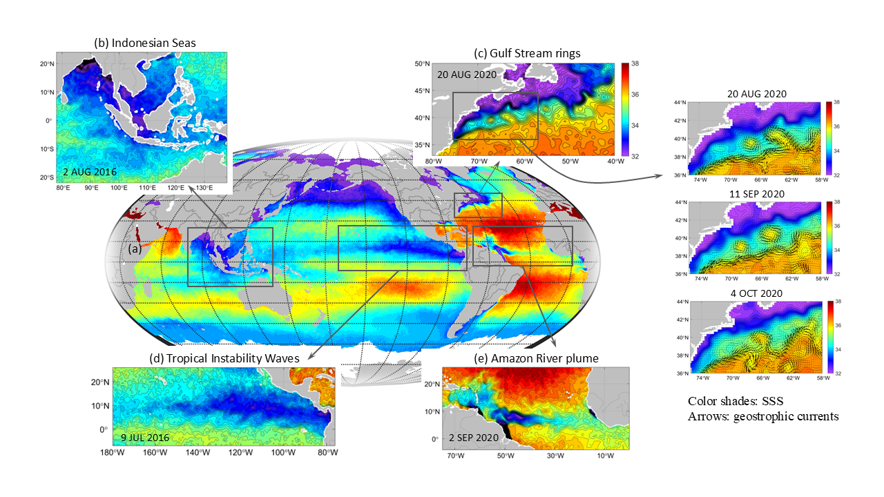
Example plots of OISSS v3.0: